The quality of life in the Genesee-Finger Lakes Region is directly influenced by the safety, efficiency, and reliability of the regional transportation system. Transportation infrastructure provides residents and visitors with mobility and access to homes, workplaces, commercial and retail services, and educational and recreational opportunities. In addition, the transportation system handles freight shipments to, from, and within the region; impacts economic development trends and opportunities, and influences growth patterns.
In many respects, the Genesee-Finger Lakes Regions transportation system provides it with comparative advantages over many other areas in the state and country. Since the mid 1990s, transportation management agencies in the region have increasingly turned to Transportation System Management and Operations strategies to protect and enhance these advantages.
Transportation System Management and Operations
Transportation System Management and Operations (TSMO) refers to practices that optimize the performance of the transportation system by using advanced technologies and enhanced interagency coordination to better manage and operate roads, bridges, intersections, and other elements of the transportation system.
Key benefits of TSMO strategies include improved mobility, increased safety, and reduced costs.
-
Improved mobility: Mobility is the ability of people and freight to get where they need to go.
TSMO strategies improve mobility by providing travelers with information they can use both before and during a trip to plan a route, decide the best time to travel, and determine the best mode (e.g., car, bus, bicycle, on foot, carpool, etc.) to use to reach a destination. Improved mobility leads to a better quality of life because less time spent behind the wheel means more time to spend on more rewarding and productive activities.
-
Increased safety: TSMO strategies improve public safety by providing travelers with timely and accurate information about adverse weather conditions, traffic incidents, work zones, and other potential hazards.
With regards to incidents, TSMO strategies enable faster detection, verification, response, and clearance. This reduces the time needed for traffic to return to its normal flow and reduces the frequency of secondary incidents. In addition, notification of the incident can be broadcast to the public, which gives drivers the choice to take a different route and avoid any travel delay caused by the incident.
-
Reduced costs: TSMO strategies generate many financial benefits for both the public and private sectors. By making more efficient use of existing road space, TSMO strategies can increase road capacity for less money, time, and disruption than the traditional method of increasing capacity by expanding existing roads or building new ones. This frees up money to invest in preventive maintenance projects that extend the life of transportation facilities.
Businesses directly benefit from TSMO strategies that decrease delivery times, reduce costs such as fuel consumption and vehicle wear and tear, allow buyers and sellers to better track freight shipments, and diminish the likelihood of thefts and incidents that could disrupt delivery schedules.
Intelligent Transportation Systems
Intelligent Transportation Systems (ITS) are technologies that are used to improve the management and operation of the regional transportation system. The goals of ITS technologies are to increase road efficiency and capacity, improve safety, reduce environmental costs, and enhance personal mobility. ITS instruments provide the enabling tools that support the implementation of TSMO strategies.
ITS technologies offer a variety of benefits, including:
- Increased system capacity through more efficient use of existing infrastructure, particularly in response to non-recurring congestion;
- Cost-effective alternatives to traditional forms of transportation investment such as capacity expansion;
- Improved real-time system management capabilities, including those resulting from incidents and other emergencies;
- Better-informed travelers through the provision of real-time traveler and weather information;
- Better-informed and more responsive transportation agencies with greater understanding of needs and conditions at various times of day, under variable conditions, and across locations;
- Improved operational performance of multimodal transportation systems, including transit and freight reliability;
- Increased safety and security; and
- Reduced environmental impacts.
ITS represents the next step in the evolution of the overall transportation system. As information technologies and advances in electronics continue to revolutionize all aspects of the modern-day world (from homes, stores, and offices to schools and recreation), they are also being applied to the transportation system. These technologies include the latest in computers, electronics, and communications and safety systems. ITS technologies can be applied to all modes of transportation, including cars, buses, trucks, trains, ferries, bicycles, and pedestrians. The results include improved mobility, safety, air quality, and productivity as well as reduced fuel consumption.
ITS technologies currently deployed or planned for deployment in the Genesee-Finger Lakes Region include:
- Traffic signal management (e.g., coordinated signal timing, traffic/emergency signal preemption, etc.)
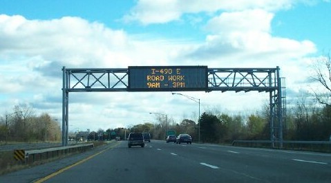
- Expressway management (e.g., traffic cameras, dynamic message signs (DMS), Highway Emergency Local Patrol (HELP) trucks, etc.)
- Transit management (e.g., advanced vehicle location (AVL), computer-aided dispatching (CAD), electronic fare payment (smart cards), etc.)
- Incident management / emergency response (e.g., automated incident detection systems, computer-aided dispatching, E-911, etc.)
- Electronic toll collection (E-ZPass)
- Parking management (e.g. parking guidance/navigation systems, electronic fee payment, multi-space electronic pay stations, etc.)
- Commercial Vehicle (CV) operations (e.g. electronic registration and permitting, electronic screening (weigh-in-motion scales), asset tracking, etc.)
- Railroad crossing safety (e.g., side-mounted radar, vehicle warning systems, gate controls, etc.)
- Traveler information (e.g., 511NY system, Highway Advisory Radio (HAR), text message alerts, smartphone travel information apps, etc.)
In the Genesee-Finger Lakes Region, ITS deployments are guided by a strategic plan. The regions first strategic plan was the Improved Mobility Areawide Guidance Evaluation (IMAGE) study. Completed in 1996, this effort involved Federal, State, and local officials, including GTC. The IMAGE study inventoried all existing and proposed ITS instrumentation in the region and recommended a series of specific ITS-related projects, including building a multi-agency traffic operations center, and establishing expressway service patrols. The IMAGE study served as the strategic plan for ITS deployments in the Genesee-Finger Lakes region until 2011, when a new ITS Strategic Plan was completed (see below, ITS Strategic Plan for Greater Rochester).
Rural Intelligent Transportation Systems
ITS deployments are typically focused in urban and suburban areas because of the greater amount of travel in those areas. However, ITS can also be used to improve safety, efficiency, and reliability in rural areas as well.
While many of the specific ITS technologies deployed in rural areas are similar to those used in urban and suburban areas, rural roads offer a unique set of considerations which impact traveler safety and road operations. Some of these considerations include:
- More unsignalized intersections
- Limited wireless communications coverage
- Higher incidence of single-vehicle, run-off-the-road accidents
- Generally longer trip lengths
- Longer emergency response times
- Lack of alternate routes
- The presence of tourists who may be unfamiliar with their surroundings
- Relative isolation
These unique features can individually or jointly have an adverse impact on traveler safety and operational efficiency. As a result rural ITS deployments must be tailored to their settings. Factors such as communications, power supply, and operations and maintenance practices often have to be addressed with different solutions than those employed in urban and suburban areas.
The shift in rural economies from almost exclusively agriculture and natural resource-based industries to larger numbers of service and tourism-based businesses requires that rural ITS applications be consistent with tourism planning. ITS can be used to help guide tourists to their destinations, provide them with information about local businesses and tourism-related events, and even help manage traffic and parking at festivals, campgrounds, and parks.
Regional Traffic Operations Center
One of the major recommendations of the 1996 IMAGE study was to build a multi-agency traffic operations center that would consolidate regional ITS operations at one site and facilitate more effective inter-agency collaboration and coordination. This recommendation was realized in 2002 when the Regional Traffic Operations Center (RTOC) opened. Located adjacent to the Greater Rochester International Airport, this facility houses personnel from four agencies: The New York State Department of Transportation, the New York State Police, the Monroe County Department of Transportation, and the Monroe County Airport Authority.
The RTOC is the hub of regional ITS operations in the Genesee-Finger Lakes Region. RTOC personnel monitor road conditions in real time through a network of traffic cameras, program Dynamic Message Signs to display traffic alerts, and manage Monroe Countys Computerized Traffic Control System (CTCS). The CTCS monitors traffic flow conditions and automatically adjusts traffic signal timing patterns to better manage intersection throughput. The RTOC also houses dispatch facilities for state and county signal and highway maintenance crews, including workshops where signal components are maintained and repaired. Lastly, the presence of the State Police at the RTOC facilitates coordination between transportation system operators and one of the key law enforcement and incident response agencies in the region.
Transportation Management Committee
The Transportation Management Committee (TMC) consists of representatives from key agencies involved in planning, building, managing (including enforcing traffic laws), and maintaining transportation infrastructure in the Greater Rochester area. The origins of the TMC date to 1991, when stakeholders formed an Expressway Committee to discuss safety issues related to expressways. Over time, the committees discussions broadened to include many other topics; as a result the committee expanded its membership and rebranded itself as the Transportation Management Committee.
Participation in the TMC is open to any interested agency; current members include the New York State Department of Transportation, the New York State Thruway Authority, the New York State Police, the Monroe County Department of Transportation, the Monroe County Sheriff, the City of Rochester, the Rochester Genesee Regional Transportation Authority, the Monroe County Supervisors Association, and Genesee Transportation Council, which serves as the committee chair. The committee meets bi-monthly.
Typical TMC discussion topics include construction project and detour route planning and coordination; the status of major ongoing road projects and ITS deployments; traffic incident reviews/debriefings; federal and state policy and legislative updates; training and professional development activities; and other special projects, studies, or initiatives that impact the regional transportation system.
Transportation Operations and Management Feasibility Study
The Greater Rochester Transportation Operations and Management Feasibility Study was prepared in 2006 to examine the effectiveness of interagency coordination on TSMO issues, including ITS deployments. The study identified several action items for regional stakeholders to implement, including updating the IMAGE study and developing a Regional Concept of Transportation Operations (see below, Regional TSMO Planning Initiatives).
The study steering committee consisted of representatives from the New York State Department of Transportation, the New York State Thruway Authority, the Monroe County Department of Transportation, the City of Rochester, the Rochester Genesee Regional Transportation Authority, and Genesee Transportation Council. The full report can be accessed by clicking on the link below.
The Greater Rochester Transportation Operations and Management Feasibility Study
ITS Strategic Plan for Greater Rochester
In 2011, regional stakeholders completed the strategic plan update that was recommended in the 2006 Feasibility Study. The purpose of the ITS Strategic Plan for Greater Rochester is to provide a strategy for the coordinated deployment of ITS instrumentation in the Greater Rochester area over the next ten years. Due to rapid technological advances in the ITS field, the Strategic Plan emphasizes the capabilities that regional transportation management agencies will develop rather than the specific technologies that will be used to realize those capabilities. In this respect, it is more than just an ITS plan; it is a comprehensive Transportation System Management and Operations plan.
The ITS Strategic Plan steering committee consisted of representatives from the New York State Department of Transportation, the New York State Thruway Authority, the New York State Police, the Monroe County Department of Transportation, the Monroe County Sheriff, the City of Rochester, the Rochester Genesee Regional Transportation Authority, and the Genesee Transportation Council. The full report can be accessed by clicking on the link below.
Intelligent Transportation Systems (ITS) Strategic Plan for Greater Rochester
Rochester-Genesee Regional ITS Architecture
The Rochester-Genesee Regional ITS Architecture is an application that documents the links between all the ITS stakeholders in the Greater Rochester area. The ITS Architecture maps the data flows between and among these stakeholders and identifies both existing and planned ITS capabilities. It is designed to be a living document that is routinely updated to reflect the deployment of new ITS instrumentation and the participation of stakeholders in regional ITS initiatives. The ITS Architecture was first developed as part of the IMAGE study effort and has been periodically updated since then. The most recent update occurred following the completion of the ITS Strategic Plan for Greater Rochester Plan in 2011.
Guide to Transportation System Management and Operations
According to a recent survey published by the Mineta Transportation Institute at San Jose State University, respondents did not feel that expanding technologies to better manage and operate the transportation system was a high priority. Some of this may be attributable to a lack of understanding regarding the ability of TSMO initiatives to improve safety, efficiency, and reliability in a more cost-effective manner than more traditional, capital projects.
To ensure that the role and benefits of TSMO are more fully understood by policymakers and the general public, the Genesee Transportation Council has developed the Guide to Transportation System Management and Operations in the Genesee-Finger Lakes Region. The Guide provides critical information about TSMO in a concise, easy-to-read format suitable for elected officials, citizens, and other non-transportation professionals. The Guide discusses what TSMO is and the opportunities it provides, presents specific examples of how it is being applied in the Genesee-Finger Lakes Region, and includes links to resources for those who wish to learn more. The Guide can be accessed by clicking on the link below.
Guide to Transportation System Management and Operations in the Genesee-Finger Lakes Region
NYS Route 96 Traffic Signal Coordination Study
The NYS Route 96 Traffic Signal Coordination Study was undertaken to improve traffic operations on one of the regions key commuter and commercial corridors. The study identified strategies to monitor and optimize traffic signal timing along NYS Route 96 from Bushnells Basin to the Village of Victor. This section of the corridor includes one of the regions three main shopping malls (Eastview) along with other retail centers, employment centers, and residential areas.
Study recommendations included modifying signal timing at 14 intersections, modifying signal phasing at two intersections, changing cycle lengths in the Village of Victor, and improving signal timing patterns in the Village, Bushnells Basin, and around Eastview Mall. The study analyzed the potential for a communications connection to the RTOC that would enable remote signal monitoring and control.
The benefit/cost analysis performed for this study resulted in a benefit/cost ratio of approximately 10.5:1. Associated but non-quantifiable benefits include reduction in emergency response times, reduction of secondary incidents when initial incidents are cleared more quickly, and improved signal maintenance. The full report can be accessed by clicking on the link below.
NYS Route 96 Traffic Signal Coordination Study
Current Regional TSMO Planning Initiatives
Several initiatives related to TSMO planning are currently underway in the Genesee-Finger Lakes Region, including the preparation of a Regional Concept of Transportation Operations, the identification of diversion routes for Principal Arterials, and ITS deployments aimed at improving mobility and accessibility at the Port of Rochester.
Regional Concept of Transportation Operations
One of the recommendations in the 2006 Greater Rochester Transportation Operations and Management Feasibility Study was the development of a Regional Concept of Transportation Operations (RCTO). A RCTO identifies goals and objectives for transportation operations and what is needed to achieve them, including physical improvements, relationships and procedures, and resource arrangements.
According to the United States Department of Transportation (USDOT), a RCTO serves three important purposes:
- A RCTO presents a mutually-agreed upon operations vision for transportation systems management and operations based on a holistic view of the region. It guides interagency coordination efforts by bringing together varied transportation operations perspectives from different agencies and jurisdictions to provide a common approach for a common objective. Through this effort, an RCTO assists participants in coordinating priorities, leveraging resources, and alleviating duplicative efforts.
- The RCTO can garner commitment from agencies and jurisdictions for a common regional approach to transportation management and operations.
- A RCTO provides an opportunity to strengthen the linkage between regional planners and operations managers by providing a coherent operations strategy for consideration in the transportation planning process.
Work on this regions RCTO began in 2011. The deliverables will be a series of technical memoranda and a high-level Memorandum of Understanding (MOU). The technical memoranda will provide the framework for implementing a series of interagency agreements on specific TSMO-related issues, while the MOU will signify member agency willingness to collaborate on issues of regional significance.
Diversion Route Planning Initiative
In 2012, GTC member agencies began working on the Diversion Route Planning Initiative, which will identify diversion routes for Principal Arterial roadways in the region. If a road, or a section of road, is closed due to a major traffic incident, severe weather such as a flooding event, or some other public safety emergency, transportation agencies and emergency management officials in the region can use this study to safely and efficiently divert traffic to alternate routes.
Project tasks include inventorying the physical and operating characteristics of Principal Arterials, identifying and assessing potential diversion routes, and determining preferred diversion routes. Traffic diversion protocols from three peer regions will be assessed to identify potential applications to the Genesee-Finger Lakes Region.
The project steering committee includes representatives from the New York State Department of Transportation, the New York State Thruway Authority, the New York State Police, the Monroe County Department of Transportation, the Monroe County Sheriff, the City of Rochester, the Rochester Genesee Regional Transportation Authority, and the Genesee Transportation Council.
Port of Rochester Security/ITS Project
The Port of Rochester, located at the mouth of the Genesee River about nine miles north of downtown Rochester, is the site of significant public and private investments as plans to build a new marina and redevelop nearby building sites with new residential, commercial, and retail space are advanced. The Port of Rochester Security/ITS Project will address congestion management, parking management, and transit management, especially during special events and associated road closures in the vicinity of the Port.
The ITS deployments recommended in this study are aimed at providing transportation management and public safety agencies with improved awareness of traffic, transit, and parking conditions in and around the Port. These ITS deployments will also provide real-time traveler information to motorists and transit riders both before they depart and while they are en route to the Port. The study will identify specific ITS instrumentation that will be deployed in the Port area, including traffic cameras, DMS, and real-time transit information signs. In addition to the public sector stakeholders mentioned above, the study engaged local businesses and community organizations who have a stake in the operation of the Port of Rochester.
TSMO Links